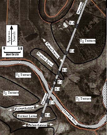
Using aerial photopgraphy to interpret historic geomorphic features suitable for habitation.