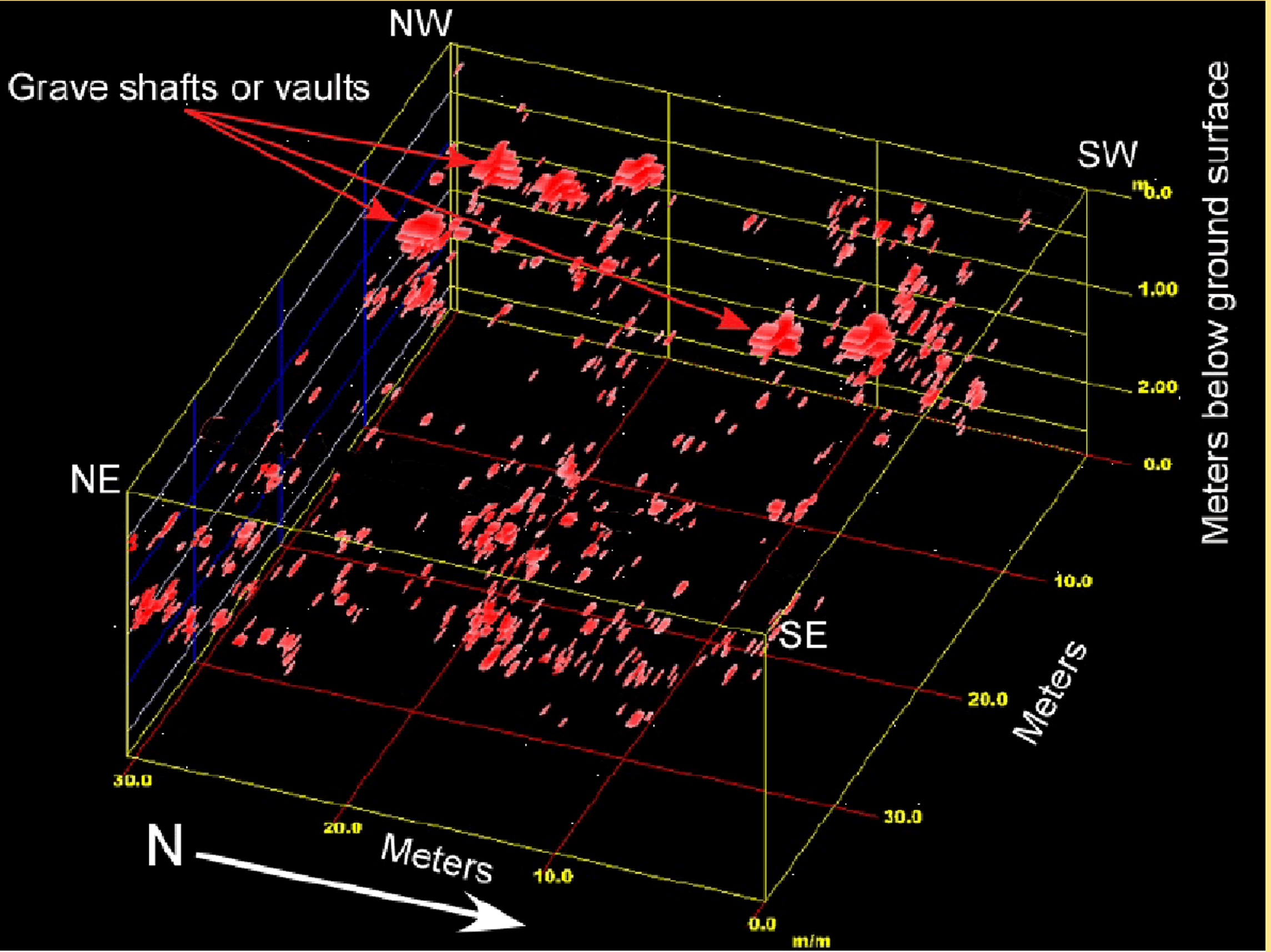
Once GPR data has been processed a 3-D model fo the data can be created to interpret buried subsurface features